Thursday, March 3, 2011

"De la Esse" and "Saint Exupery"


Here at two of the peaks of the Fitzroy massif. On the left is the peak known as "de la Esse." On the right is the tower, or needle ("aguja" in Spanish), of "Saint Exupery" named after the French flyer and author of "The Little Prince."

Piedras Blancas Glacier


The Piedras Blancas Glacier descends from the Fitzroy massif into the valley of the Rio Blanco.

Interpreting the Landscape


David interprets the landscape above the Rio Blanco near its confluence with the Rio Electrico. We are en route to El Chalten via Laguna de los Tres and Laguna Capri.

Cerro Electrico


The peak of Cerro Electrico rises above the Rio Blanco near the Hosteria El Pilar at the start of our hike to Laguna de los Tres, Laguna Capri and El Chalten.

Wednesday, March 2, 2011

Autumn is coming


The golden leaves of this ñire tree (Nothofagus antarctica) hint at the approach of the austral autumn.

The Bifida Tower


The impressive spire of the Cerro Torre is surrounded by an entourage of similarly shaped towers. The one in the picture above is called the Aguja Bifida, or Torre Bifida. It rises to an elevation of 2,400 meters. But it is dwarfed by the Cerro Torre which rises another 700 meters higher.

El Viento Patagonico


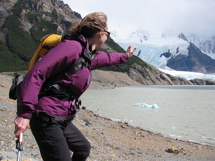
Confronting the fierce winds of Patagonia at the Laguna Torre, Los Glaciares National Park, Argentina.

Laguna Torre


The wind was whipping across Laguna Torre and the high peaks were obscured by clouds, but it was still, without doubt, an impressive scene. The iceberg floating in the lake to the left of the picture flipped over while we were there. In the left background, glacial ice descends from the Cordon Adela. In the right background, the lower portions of the Cerro Torre, Torre Egger and Torre Standhardt can be seen.

Boardwalk Trail near Laguna Torre


A stretch of boardwalk trail traverses a wetland near the glacial moraine that impounds Laguna Torre.

In the valley of the Rio Fitzroy


David interprets the landscape as we make our way up the Rio Fitzroy toward Laguna Torre. Glacier-clad Cerro Solo rises in the background.

To Laguna Torre


It was a sunny morning in El Chalten, but clouds obscured most of the high peaks and the wind was blowing mightily. A typical Patagonian summer day.

Tuesday, March 1, 2011

Home Sweet Home in El Chalten


Our home for the next four nights in El Chalten. We'll be hiking in the Fitzroy Sector of Los Glaciares National Park. To Laguna Torre tomorrow!

Cerveceria, El Chalten


Celebrating the end of the road journey (now 100% paved) from El Calafate to El Chalten at a microbrewery in El Chalten. Cervezas rubias around the table! Salud!

Glaciar Perito Moreno


The face of the Perito Moreno Glacier in Argentina's Los Glaciares National Park. This glacier is one of several tongues of ice that descend from the Hielo Sur, or the Southern Patagonian Icefield. The glacier moves forward at speeds of up to 2 meters per day.

Sunday, February 27, 2011

El Condor Pasa


An adult male (?) Andean condor floats majestically above us as we descend from the Otto Meiling Refuge on Monte Tronador. Such a stunning sight!

The Castana Overa Glacier


Post lunch relaxation at the edge of the Castana Overa Glacier, one of several that drape the slopes of Monte Tronador.

We made it!


The Otto Meiling Refuge at last! Inside, spaghetti bolognese and spaghetti aglio olio will be served to the music of Louis Armstrong. And all of this high on an old volcano in Patagonia. Amazing!

Sunrise on Monte Tronador


Morning light touches the peak of Monte Tronador ("the thunderer"). Today we'll hike up to the Otto Meiling Refuge on the slopes of this old volcano. We can hear the occasional cracking and rumbling of glacial ice from Pampa Linda.

Saturday, February 26, 2011

Lago Mascardi


Exquisitely colored Lago Mascardi en route to Pampa Linda from where we'll hike up to the Otto Meiling Refuge 3,300 feet up the slopes of Monte Tronador.

Friday, February 25, 2011

Turistas al cumbre de Pico Turistas


At the top of Pico Turistas, one of the several high points along the Cerro Lopez summit ridge. The big glacier-clad volcano to the right in Monte Tronador ("the thunderer").

From the trail to Cerro Lopez


A stunning view of Nahuel Huapi Lake from the trail to Refugio Lopez compensates for the effort of the hike.

Llao Llao


Another perfect day in Patagonia. Hikes on Cerro Lopez on tap for today. En route to the trailhead, stopped to enjoy this lovely view of the Llao Llao Hotel with the Moreno Lake in the foreground and the enormous Nahuel Huapi Lake in the background.

Thursday, February 24, 2011

Group shot at Lago Gutierrez


On the long hike out from Laguna Tonchek, we stopped for a group picture overlooking Lago Gutierrez.

Laguna Tonchek


Gorgeous day for our first hike in northern Patagonia. Today we headed to the Laguna Tonchek named for a Slovenian climber, Tonchek Pangerc. A long hike up the Arroyo Van Titter lead us to this exquisite alpine tarn backed by the spires of Cerro Catedral.

Group at Laguna Tonchek


Group at Laguna Tonchek on our first hike in Argentina's Nahuel Huapi National Park.

Sunrise on Nahuel Huapi

Morning majesty over the waters of Lago Nahuel Lake. A hike up the Arroyo Van Titter to Refugio Frey and Laguna Toncheck await today.

Wednesday, February 23, 2011

In Patagonia


A rainbow arches over Lago Naheul Huapi seen from the Hotel Cacique Inacayal in Bariloche. I have arrived in northern Patagonia and it's lovely.

Saturday, January 15, 2011

Homeward Bound


Time to head for home. The Po'ouli ("black-faced honeycreeper") carries me from Lihu'e to Honolulu where I'll catch a flight back to Portland. A hui hou kakou malama pono, Hawai'i!

Friday, January 14, 2011

Nualolo Viewpoint


From the end of the Nualolo Ridge Trail, one gets this marvelous view looking up the Na Pali Coast. You can see all the way to Ke'e Beach (where the Na Pali Coast trail begins). I've seen photos from 1913 showing horseback riders enjoying the view from this place. I don't think you could get a horse down here today, though!

Rainbow over Nualolo


From Awa'awapuhi Viewpoint, some of us set off on the Nualolo Cliffs Trail bound for Nualolo Ridge. En route, the typical Hawaiian weather of "mauka showers drifting makai" conjured this beautiful anuenue (rainbow) arching across the Nualolo Valley. Oh, mauka means "toward the mountains" and makai means "toward the sea." Nualolo, I've learned, means "heaped up brains." The Nualolo Valley was once inhabited, perhaps as far back as 600 A.D. which was about the time the Tahitians settled Hawaii in the second wave of Polynesian migration.

Awa'awapuhi Viewpoint


Last day of hiking on the Garden Isle. Drove back up to Koke'e State Park and headed down the Awa'awapuhi Trail (awapuhi = wild ginger). It was foggy at Koke'e but as we descended we broke out into glorious sunshine and enjoyed this stunning view at Awa'awapuhi Viewpoint high above the Na Pali Coast.

Thursday, January 13, 2011

Waimea Brewing Company


Time for a post-hike refreshment. A pint of Na Pali Pale Ale at the Waimea Brewing Company.

Waimea Canyon from the Kukui Trail


Off and on rain showers again today. The highlands look a bit fogged in from Waimea, but we drive up to the Kukui Trailhead in Waimea Canyon State Park. It's foggy, but it isn't raining and we set off descending the switchbacking trail into what Mark Twain called the "Grand Canyon of the Pacific." We drop below the fog layer and the colorful walls of the canyon come into view; waterfalls stream off the cliffs.

Waimea Plantation Cottages


We arrived at Aston Hotels' Waimea Plantation Cottages just as the sun was going down on January 12. Most of the cottages are from the old Waimea Sugar Plantation; a few were brought in from other plantations. The cottages been restored and provide a unique overnight experience on Kauai's south shore. Here's cottage #54 seen in the morning light.

Wednesday, January 12, 2011

Wailua Falls


The rains over the last few days have made for some wonderful waterfalls. While part of the group is hiking on the Sleeping Giant, a few of us head up to Wailua Falls to watch the spectacle. This is the waterfall from the old Fantasy Island television series. Normally it's composed of two separate streams of gracefully falling water, but today, it's a raging cataract.

The Sleeping Giant


Part of the group sets off on a morning walk up the Kuilau Ridge Trail. After lunch, it's a traverse of Nounou Mountain, commonly called the Sleeping Giant. Off and on showers today; this photo was taken on January 9.

Tuesday, January 11, 2011

The Na Pali Coast


This is one of Hawaii's legendary trails. You can, with a permit, walk it's entire 11 mile length to Kalalau Valley. Amy and I did this as a three-day trip a few years back; we camped at Hanakoa on the first night and at Kalalau on the second, then walked out all the way on the last day. Today, our aim is Hanakapi'ai Beach, and some of the group will push on an additional 4 miles (round trip) to Hanakapi'ai Falls. Even though the falls are only 2 miles from the Hanakapi'ai Beach, Matt reminds us that these are 2 "Hawaiian miles" over rough terrain so the going is slower than most people would expect.

Na Pali Coast Trail to Hanakapi'ai


Magnificently sunny day today! Off to the end of the road at Ke'e Beach (Haena) from where we head off on the Na Pali Coast Trail bound for Hanakapi'ai Beach and Falls. Despite the rain over the past few days, the trail is in good condition.

Monday, January 10, 2011

Volcano Spiced Walu


From Koloa, it's back to the Coconut Coast for a welcome dinner at Wahooo Seafood Grill (yes, there are 3 "o"s in the name) . Here is the "Volcano Spiced Walu" (escolar, or "Hawaiian butterfish").

The Old Koloa Church


The old Koloa Church in the erstwhile plantation town of Koloa was established by Congregational missionaries in the early 19th century. It looks like it belongs in New England!

The Hapa Road, Poipu to Koloa


We travel by vehicle from Kawailoa Bay to the Spouting Horn as the sun breaks through. Under blue skies we enjoy a walk on historic Hapa Road to the old plantation town of Koloa. Here, seen from the Hapa Road, the roof of St. Raphael's Catholic Church (founded in 1841 and the oldest on Kauai) peeks above the brush and cactus.

Maha'ulepu Heritage Trail


Off to Poipu to hike the Maha'ulepu Heritage Trail from Shipwrecks Beach almost to Papa-mo'i Point. It's a showery day, but it's still lovely. They tell us there's snow on the ground in 49 or the 50 states. No snow to be seen here! Just tropical rains, so how bad can it be? Here is lovely casurina-shaded Maha'ulepu Beach. The Waiopili Stream enters from the left.

Makauwahi Cave


The group gets to visit a portion of the limestone sinkhole known as Makauwahi Cave where paleo-ecological and archeological excavations are underway. It's a showery morning, but the rains let up and allow us to enjoy a dry lunch under the casurina trees at Kawailoa Bay. After lunch we push on toward Ha'ula, but a drenching rain forces us back at Papamo'i Point.

Sunday, January 9, 2011

Morning on the "Coconut Coast"


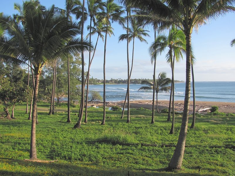
Today, the group assembles at the Outrigger Waipouli Resort on Kauai's east coast--the "coconut coast." Most of us go out to enjoy dinner this evening at the Hukilau Lanai next to the Coconut Marketplace. Great fish selections including fresh opah (moonfish).

Saturday, January 8, 2011

From Papa-mo'i Point, Maha'ulepu Trail


In the afternoon, a walk on the Maha'ulepu Heritage Trail on the coast east of Poipu leads me to Papa-mo'i Point and lovely views of sea and mountain. Then, a quick visit to Koloa town rounds out the day.

Awa'awapuhi Valley


An hour and a half later I am at Awa'awapuhi Viewpoint for more glorious Na Pali Coast views.

Nualolo Cliffs


Early morning drive to Waimea and the little Obsessions Cafe run by Dennis Okihara. At 6:45, a classic "loco moco" (hamburger patty, fried eggs, brown gravy and 2 scoops rice) + a cup of Black Mountain coffee from Kauai gets me fired up for the day. Up to Koke'e State Park to check out conditions on the Awa'awapuhi-Nualolo Loop Trail. 2 hours of hiking brings me to the Nuaolo Lookout where I am met with a fierce little squall...pounding rain and zero visibility. After 10 minutes of this, the rain stops, the clouds part and the cliffs of the Nualolo Valley and the Na Pali coast come into view. The little washout on the Nualolo Cliffs Trail is not a bad as the warning signs suggest.

Friday, January 7, 2011

Pono Market, Kapa'a


Once on Kauai, I zipped off to Kapaa's Pono Market for some local snacks, but it was too close to closing and the cupboard was bare. Alas!

Hawaiian Birds


Hawaii bound from PDX on Hawaiian Airlines. Their B-767 'Akekeke carries me to Honolulu; then the B-717 'Apapane whisks me to the island of Kauai. Hawaiian Airlines names their wide-body 767 jets after Hawaiian sea or shore birds (mostly) and their smaller inter-island jets after Hawaiian forest birds. 'Akekeke is the ruddy turnstone (Arenaria interpres), and 'apapane is Himatione sanguinea, a beautiful red bird that feeds on nectar from the ohia-lehua tree.

Thursday, July 1, 2010

June 30: Bregenz, Austria. The sun goes down over the Bodensee enjoyed by diners under the gazebo.