Saturday, March 24, 2012

Post Hospital, Fort Davis National Historic Site

The town of Fort Davis in only about 30 minutes from Alpine. We stopped for an hour and a half there to visit the Fort Davis National Historic Site (one of the units of the National Park System). The old post hospital has just been restored and is now open to the public. Here's the post hospital backed by the rocky pinnacles of the Davis Mountains.

Leaving Alpine

Beautiful morning in Alpine, Texas. Spent last night at the Holland Hotel after a great dinner at Reata Restaurant. This morning enjoyed a great breakfast at Judy's Bread and Breakfast (compliments of the Holland Hotel). We're heading back to El Paso today.

Friday, March 23, 2012

Devil's Den Hike

The Devil's Den from the canyon's south rim.
At the "top of the den." Enjoying the shade of a dagger yucca above the Devil's Den.
A Turk's Head cactus on the hike to the Devil's Den.
Hedgehog cacti near the Devil's Den.

Thursday, March 22, 2012

Hike to the South Rim

Hiked today from the Chisos Basin to the South Rim (Chisos Mountains). 12.1 mile loop hike. Started at 8:00 AM from Chisos Basin and caught this view of sunrise through the Window.
 At the "top" of the Laguna Meadows Trail, about 3.5 miles and 1,600 vertical feet up from Chisos Basin.
 Deer on the trail near the junction with the Colima Trail.
 The view south toward Mexico from the South Rim, Chisos Mountains.
 At the South Rim.
At the precipice, South Rim, Chisos Mountains, Big Bend National Park.

Wednesday, March 21, 2012
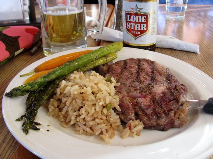
Ribeye Dinner

My ribeye steak dinner at the Chisos Mountains Lodge prepared, as they would say in Argentina, "vuelta y vuelta." Yum!

Mule Ears Spring and Peaks

The group at Mule Ears Spring--a desert oasis and a perfect spot to lunch!
Cactus blossom on the trail to Mule Ears Peaks.
Cactus in bloom!
The appropriately named Mule Ears Peaks.
We named this little butte "Boot Butte with James Dean." Looks like a hiking boot with James Dean leaning on the heel!

Santa Elena Canyon

"Luna's Jacal." The remains of the shelter built by Gilberto Luna, an early homesteader in the region. This site is on the Old Maverick Road, twelve miles of improved gravel road leading from the park's west entrance station to the Santa Elena Canyon.
 The Rio Grande emerging from the Santa Elena Canyon.
 Ocotillo in bloom above the Rio Grande at the mouth of Santa Elena Canyon. It's a short 1.8 mile round trip hike into the canyon from the parking area.
 The Rio Grande as it emerges from the Santa Elena Canyon (taken from inside the canyon looking out). The Chisos Mountains rise in the distance.
 The old store at Castolon. Time for an ice cream break!

Tuesday, March 20, 2012

Day's End at the Chisos Mountains Lodge

A Texas classic! Chicken-fried steak and a Lone Star beer at the Chisos Mountains Lodge!
The view of sunset through the Window from the terrace of the Chisos Mountains Lodge.

Hiking from Sam Nail Ranch to Chisos Basin

Left the Chisos Basin this morning by vehicle to drive around to the Sam Nail Ranch on the Ross Maxwell Scenic Drive from where we hiked back to the Chisos Mountains Lodge via the Oak Springs and Windows trails. On the drive out of the Chisos Basin we were treated to this view of the Chisos Mountains in the morning sunshine.
 Rocky spire seen from the Oak Springs Trail.
 Ascending the Oak Springs Trail. The trail climbs in a series of switchbacks to a point above the Window then descends to meet the Window Trail above the Window "pour off."
 Above the Window.
 Claret cup cacti in bloom!
 The Window "pour off." The waters draining the high Chisos Basin funnel through this narrow gap to drop to the desert flats below.
 The group at the Window.
 Looking back at the Window as we neared the end of the hike at the Chisos Mountains Lodge. About 7.5 miles and 2,000 feet of elevation gain today.
"Long-tailed" columbine at Cattail Falls.

Monday, March 19, 2012

Lost Mine Trail

View back toward the Window from the Lost Mine Trail. The road entering the Chisos Basin can be seen at the lower right.
 On the Lost Mine Trail.
 A view of the peak of Casa Grande from the Lost Mine Trail.
 Rock pinnacles rising above Juniper Canyon near the end of the Lost Mine Trail.
Casa Grande peak (left) from the end of  the Lost Mine Trail.

En route to Big Bend National Park

A view over Marfa, Texas from the dome of the Presidio County Courthouse. We stopped here for a leg-stretcher.
Lunch time! Fish tacos southwestern style at Reata Restaurant in Alpine, Texas.

Sunday, March 18, 2012

El Capitan, Van Horn, Texas

We are lodging tonight in Van Horn, Texas en route to Big Bend National Park. We're enjoying the comfort of the Hotel El Capitan, a 1930s era hotel designed by the West Texas architect Henry C. Trost. The hotel has been beautifully restored...the crown jewel of quiet and otherwise unassuming Van Horn, Texas.
Dinner in the hotel restaurant. Here's my meal: roasted pork tenderloin with raspberry chipotle sauce on a bed of jasmine rice with green beans. Along with this, a glass of Texas wine--a 2009 Sangiovese made by Val Verde Winery in Del Rio, TX. Wow!
The lovely lobby of the Hotel El Capitan.
Reading material in the lobby of the Hotel El Capitan.

Chamizal National Memorial, El Paso

Visited the Chamizal National Memorial this morning. It's a unit of the National Park System in El Paso, Texas. The memorial commemorates the 1963 settlement of the Chamizal border disupte between the United States and Mexico. The changing course of the Rio Grande which forms the boundary between the U.S. and Mexico was the cause of the dispute. This is a mural on the walls of the visitor center at the Chamizal National Memorial.
Old boundary marker between the U.S. and Mexico. Prior to the Chamizal settlement of 1963, the land to the right of the marker was part of the Cordova "island," part of Mexico that was nearly surrounded by the United States. Today the land to the right of the marker is part of the United States.

Thursday, March 8, 2012

Buen dia, Patagonia!

Leaving Patagonia today to head back to Portland. A fabulous sunrise over Lago Argentino to wish us all buen viaje!

Wednesday, March 7, 2012

Lago Sarmiento and the Paine Massif

A parting shot of the Paine massif rising over Lago Sarmiento as we make our way to the border post at Cerro Castillo.

Monte Almirante Nieto & the Torres del Paine

Leaving Torres del Paine National Park (Chile) to head back to Argentina. The peaks of Almirante Nieto (left with snow) and the Torres del Paine emerged from the clouds to bid us farewell.