Wednesday, May 13, 2020

Launching Our Love Affair with Travel 

The Mountain Hiking Holidays Creation Myth

BY JOHN OSAKI, MAY 13, 2020


In the spring of 1987 my wife Amy and I drove up to Acadia National Park in Maine. We were living in Wilmington, Delaware at the time and had discovered Acadia Park two and a half years earlier in the fall of 1984. We had fallen in love with it then and had vowed to return. On our return trip in 1987 we explored the less-frequented corners of the park including the area surrounding fjord-like Somes Sound and Isle au Haut, an island accessible by mail boat from the village of Stonington.
Amy at Stonington harbor, Maine en route to Isle au Haut in 1987.
With the exception of Isle au Haut and the Schoodic Peninsula, most of Acadia National Park is spread across Mount Desert Island whose principal town is Bar Harbor. While wandering through a shop in Bar Harbor we happened upon a poster that stopped us in our tracks. On the poster was an image of sharp, serrated peaks rising abruptly from the sea with the houses of a small fishing village clustered in the foreground. The landscape depicted in the image seemed almost otherworldly. It looked like a matte painting created for the background of a fantasy motion picture. Beneath the picture was the word, "Norway." That was the only hint about the location depicted in the image; we could find no other information on the poster. We were so entranced by the landscape presented on the poster that we determined to uncover its precise location.


The poster that enchanted us in Bar Harbor, Maine. A framed copy of this poster has hung on the wall of our home for over 30 years.

Fortuitously a few days after we returned home as I was going through the "junk mail" in my work inbox I came across a promotional brochure from a cruise line. Lo and behold! On the cover of the brochure was the same image that we had seen on the poster in Bar Harbor. I opened the brochure and eagerly scanned the copy for a caption or anything that might provide a clue to the location of the village in the photograph. As with the poster, no caption could be found, but there was a line in the brochure copy that read, "Wednesday, July 8: In the remote Lofoten archipelago is some of the most spectacular scenery to be found anywhere in Norway; fairy tale villages by the edge of the sea, with jagged mountain peaks looming in the background..." That passage seemed to describe the image on the brochure cover so I assumed our search could be narrowed to Norway's "Lofoten archipelago."

Since Amy was working on her masters degree in American Material Culture from the Henry Francis DuPont Winterthur Museum and the University of Delaware I accompanied her one weekend to the campus in Newark and sequestered myself in the library. I tracked down every book I could find about the north of Norway and proceeded leafing through the sections about Lofoten. In one of those books, I stumbled on a black and white photograph of a fishing village in the Lofoten islands. The mountains in the photograph looked similar to the peaks depicted on the poster and brochure, but at first glance they did not appear to match. Then I looked more closely, carefully comparing the clefts and gullies etched into the mountains until I realized that the peaks in the book and the peaks on the poster were indeed the same. I realized that the poster image looked more dramatic because it had been vertically exaggerated. Under the black and white photo in the book was a caption which identified the village as "Reine." The mystery was solved!


An image of Reine similar to the one I found in the book. (Photo by John Osaki)

I remember telling Amy some time after we first met in 1983 that I didn't need to travel abroad because I could happily spend my entire life in North America and still not be able to see all the mountains I wanted to see on my home continent. But the magical image of Reine in the Lofoten islands forced me to reconsider that stance. I now realized that the world was full of enchanting landscapes beyond my possible imaginings. And now, they were calling to me. So, in July of 1988, when Amy finished her master's degree, we traveled to Norway on a pilgrimage to Reine. Our objective: To stand in the spot where the photograph that had enchanted us in Bar Harbor had been taken. It was my first time to Europe and Amy's first time to Norway. Amy's great grandmother had left her family's farm in eastern Norway in the late nineteenth century and emigrated to the United States so for Amy it was a bit of a "homecoming." For me, it was also a chance to see the landscapes of a country which had fascinated me since I was a child in Hawaii leafing through the pages of my fourth grade geography book. We flew into Bergen, rented a car and explored the fjord country between Bergen and the city of Ålesund. We chose to poke about in little-known and unfrequented corners—a habit that was to become a hallmark of our travels together.


The mountain farm of Blomberg above the Geirangerfjord as it was in 1988. We had seen postcards of this farm and thought it would be fun to see if we could find it. We found its location on a topographic map, then rented a small boat and motored seven miles down the fjord from Geiranger town to Syltavika and an old fjord-side field  below the Blomberg farm. We spent a long time searching for the remains of the old farmer's path and finally found it. We trudged uphill for about 1,300 vertical feet through brush and over hidden boulders following the trace of the old path. This view was the reward. (Today, Blomberg has been restored and it's now much more easily accessible.)

After tooling about in the fjord country, we flew north to the town of Svolvaer in the Lofoten islands, rented another car, bought a cassette tape of Norwegian country music and set off to find the village of Reine. We had managed to rent a cod fishing cabin from Herr O. Hvedding in the village of Å (also spelled "Aa") at the end of the Lofoten road a few miles beyond Reine village.
Amy and Herr (Mr.) O. Hvedding, our "landlord" during our stay in the village of Å.
The fishing cabin ("rorbu") we had rented was rustic with wooden floors painted battleship gray, a large stainless steel (fish cleaning?) sink, wooden bunks and a toilet with questionable plumbing. It was built on stilts above the water so when the tide was high we could hear the ocean sloshing beneath the floor. We cooked our meals on a primitive stove and enjoyed a seafood dinner after convincing one of the workers at a local fish warehouse with a mountain-sized pile of fresh fish to sell us a single flounder--something he was clearly not used to doing!

The fishing village of Å in 1988. Our "rorbu" is the simple red building at the far left.
In our rorbu in 1988 in the village of  Å i Lofoten.
We explored the trails of the area enjoying the endless summer sunshine. We thrilled to  the sight of alpine wildflowers growing a few feet above seaweed encrusted rocks. We challenged ourselves to a swim in frigid, turquoise waters off the blazing white sands of Ramberg Beach. And we cut short a planned hike after we realized that we had started it after 11:00 PM lulled by the 24-hour light of the midnight sun. And, of course, we found the "place in the poster." We determined that the photograph had been taken from the narrow access road to Reine village. We stood on the road to take the photo you see below. There was no traffic and no one else shared the view with us that day. (Today, a constructed boardwalk separated from the roadway accommodates the large number of visitors and photographers who come to enjoy the view.)

Photograph of Reine taken by John Osaki in July 1988 using Kodachrome slide film.

A mock-up of the poster using the 1988 image by John Osaki above. In the poster view, the image has been "vertically stretched" in the manner of the original poster.

For Amy and me, that 1988 journey to Norway and the Lofoten Islands set the stage for 30+ years of international travel. It reshaped our view of the world and redefined the possibilities that travel offered. Following our Norwegian adventure, independent trips to Guatemala, Yugoslavia, El Salvador and Nicaragua followed in quick succession. All of those early journeys ended up changing our lives and charted the course that led us less than a decade later to found "Walking Softly Adventures" which became "Mountain Hiking Holidays" in the mid-2000s. We have been possessed by the joy of chasing mountains around the world ever since.

Sunday, March 25, 2018

How to make chupe de centolla - Seafood dish from southern Patagonia


In March 2016 following our Patagonia hiking trip we were treated to a Patagonia seafood specialty called, "chupe de centolla." "Centolla" is the southern hemisphere equivalent of the northern hemisphere's king crab. "Chupe" is a "stew" or "casserole." Upon returning to Oregon, I was inspired to see if I could duplicate this dish using Pacfific Northwest Dungeness crab. Here's the ingredient list, I just "guesstimated" the quantities. About 3 Dungeness crabs, picked 1/2 to 1 onion diced 1 sweet red pepper, diced Diced bread (I used sourdough) soaked in milk to make it soggy About 1 cup of heavy cream Shredded cheese for topping before baking (I used Tillamook Monterrey Jack + cheddar) Salt, pepper to taste Try it. Experiment. Hard to go wrong!

Tuesday, February 6, 2018

It's Summer Now in Patagonia!

It's February! For many of you, winter rules the month. February signals cold temperatures and long dark nights. About 88% of the world's population lives north of the equator. Bill Rankin's blog Radical Cartography has two great visual maps of the population of our planet that clearly illustrate this congregation of people north of the equator.

However, south of the equator, February is summer! Think of your favorite holiday in December, January, and February. Now picture your gathering with summer temperatures!

For three decades, we have flown south, across the equator, and experienced the joy of flipping seasons down under! A wonderful swim on New Year's Day at Wilson's Promontory National Park in Australia. Wearing winter coats in August in Santiago, Chile gazing up at the snow-clad Andes mountains. Hiking to the brink to watch the Zambezi River plunge over the precipice at Victoria Falls in Zimbabwe. And departing our home in Portland, Oregon nearly every year since 2008 to lead our hiking trip in Patagonia.

February is, in our opinion, one of the best months to hike in Patagonia. Fly into Buenos Aires, Argentina where the average monthly temperature in February is 81 degrees Fahrenheit (with a low of 68 degrees). Your day is illuminated with more than thirteen hours of daylight. Another flight, from Buenos Aires to El Calafate, Argentina, takes you nearly 3,000 miles further south, close to the tip of South America. Here at the foot of the mountains in Patagonia the average monthly temperature in February is 65°F for a high, and 46°F for a low. The summer crowds in the national parks of Patagonia peak in December and January, so now in February you'll have arrived at the shoulder season with the weather is showing hints of the transition from summer to fall.

Hiking in Patagonia in February does however remind you that regardless of the season, mountains create their own weather. Positioned at the southern end of South America, the mountains of Patagonia in Chile and Argentina bear the brunt of the weather fronts that arrive from the Pacific Ocean to the west and sweep across the continent to the Atlantic Ocean in the east. The skies above Patagonia are a great place to see lenticular clouds—those lens-shaped clouds formed when high winds aloft and the moisture they carry meet the Patagonian mountain barrier. Officially known as Altocumulus Standing Lenticular (ACSL) clouds, they are spectacular! Paolo and others trying to stand up in the wind.

Lenticular clouds at the Brazo Rico, Los Glaciares National Park, Argentina.

Braced against the winds of Patagonia in Torres del Paine National Park.

However, unlike the northern Andes in Peru and Colombia (where hikes may be at elevations of over 10,000 feet) in southern Patagonia you are frequently sleeping closer to sea level and hiking at elevations of about 3,000 feet. For example, El Chalten (Argentina's "trekking capital") sits at 1,350 feet above sea level. A favorite hike to view nearby Monte Fitzroy brings you to the shores of a mountain lake (Laguna de los Tres) nestled at an altitude of 3,800 feet. Across the border in Chile, at the the Mirador las Torres (where you can enjoy and spectacular and iconic view of the Torres del Paine) you are standing at a mere 2,800 feet above sea level!

Laguna de los Tres, Los Glaciares National Park, Argenitna.
Elevation at this viewpoint: 3,900 feet.

Mirador las Torres, Torres del Paine National Park, Chile.
Elevation at this viewpoint: 2,800 feet.

The same wind that forms the lenticular clouds may bring rain that may come at you horizontally rather than falling gently on your head. Bringing good rain gear (coat, pants, hat) and layers to stay warm is very important for summer hiking in Patagonia. An excerpt from the Mountain Hiking Holidays Patagonia Trip Book puts it this way:
It is imperative that you be fully prepared to meet Patagonia’s weather on its own terms particularly since you will be spending so much time out of doors. In order for you to be warm, comfortable, and safe please assure that your outdoor wear is of high quality, in good repair, and up to the task of fending off the region’s unpredictable weather. Be particularly attentive to preparing yourself for wind—even on sunny days, strong, steady winds are characteristic. In general, you can expect summer weather in the Patagonian mountains to be “unsettled” with cool temperatures and ever-present wind. Chance of rainfall generally increases the closer you are to the mountains. By contrast, towns built on the Patagonian steppes (like El Calafate) enjoy generally drier weather. Clouds can be persistent over the high peaks obscuring views. At the same time, massive lenticular clouds (common in the area) are a visual delight in themselves! The average summertime temperature in the Los Glaciares (Argentina) and Torres del Paine (Chile) National Parks is about 69°F with lows averaging about 40°F.
Whether you join us on the trail in Patagonia in February, or pick another destination south of the Equator, we hope you go and enjoy the pleasure of experiencing life "down under"! Happy travels and happy hiking!

Thursday, December 14, 2017

Gear Up!

Looking for gear for your next mountain hiking trip? Here are some of our favorites. After two decades of leading mountain hiking trips on four continents, these are the items we turn to again and again. In 2017, John traveled for 22 of the 52 weeks of the year, and logged 110 hiking days involving over 1,100 miles and 220,000 feet of elevation gain and loss for the year! 

Boots: We hike in leather Asolo boots. These boots provide great ankle support (they come above the ankle), traction with Vibram soles, and protection with a sturdy leather body that protects from rocks and uneven terrain. We have logged many miles on rough mountain trails with these boots. The TPS 520 GV EVO (Women's Chestnut) retails for about $315; there is a version for men, as well. Be sure to allow two to four months to break in these boots, and include at least 6 weeks of long day hikes in the mountains (five hours or more with 2,000 feet of elevation gain) to be sure these boots are really comfortable before setting off on a MHH trip. Alternatively, Merrell has an above the ankle waterproof boot that will break in much more quickly. The style is Merrell Moab 2, Mother of All Boots Mid. There is a version for men, as well. Go for a boot that supports your ankle and provides good traction. You can consider water-proof or resistant boots, but be aware that even these will lose that capability with time and use.

Socks: Wearing wool socks provides cushion for your feet, and adds a layer of warmth in case your feet do get wet. We wear Smart Wool socks (Hike Medium Crew).


Osprey 34 liter Stratos packed for five days on the Kumano Kodo Pilgrimage.


Pack: On the trail with Mountain Hiking Holidays you'll need to carry a day pack containing your rain jacket, rain pants, fleece coat, warm hat, warm gloves, water, lunch (and other personal items). A day pack with a 20 or 30 liter capacity is great. We both carry 34 or 36 liter Osprey packs (for extra safety gear).

Hat: Keeping your head dry and your face protected from the sun is a priority. We like the Seattle Sombrero by Outdoor ResearchWe find this hat to works well for us under most conditions except on the hottest days in the Sahara desert!

Please let us know what your favorite gear choices are, and we look forward to seeing you on the trail soon.

Written by Amy Boyce Osaki

Thursday, November 5, 2015

High airfares to Europe in summer 2016 getting you down?

Yup, it's true. At this moment, round trip airfares to Europe from the U.S. West Coast are pricing in the $1,850 to $2,000 range on the major U.S. carriers. (This was actually the case in the summer of 2015 when one of our travelers paid better than $2,000 for a one-stop routing from Portland, OR to Munich with a return to Portland from Lisbon.)

Options? As of now the best deals to Europe from the U.S. West Coast appear to be on Icelandair. Icelandair's routings are showing up about $300 cheaper than the big U.S. carriers (United, Delta, American).

For example as of today:

  • Portland-Seattle-Reykjavik-Munich RT on Icelandair for June 14 departure and July 21 return in 2016 is pricing at $1,582
  • Portland-Reykjavik-Munich RT on Icelandair is $1,655 (using June 15 departure from Portland since Icelandair doesn't serve Portland everyday).
  • United Airlines for the routing Portland-Houston-Munich RT is pricing at $1,872
Icelandair serves the following U.S. cities with non-stop flights to Keflavik Airport (Reykjavik) from where connections are available to many European destinations:
PORTLAND, OR
SEATTLE
DENVER
MINNEAPOLIS
CHICAGO
BOSTON
NEW YORK (JFK and NEWARK)
WASHINGTON DC (DULLES)
ORLANDO
ANCHORAGE

You can check out options are Icelandair's website at http://www.icelandair.com/

Or use the ITA Matrix (Google-owned) at http://matrix.itasoftware.com

Saturday, December 13, 2014

Icelandair Starts Seasonal Service to Europe from Portland, OR (PDX)

Good news for Portlanders (Oregon) planning to travel to Europe in summer 2015. Icelandair will be initiating seasonal service from Portland, OR starting on May 20, 2015 running through October 21, 2015. During this period flights will depart Portland on Wednesdays and Fridays at 3:40 PM and proceed non-stop to Reykjavik, Iceland arriving there at 6:15 AM the next day. In Reykjavik, connections can be made to a host of destinations in Europe. (Return service from Reykjavik to Portland operates on Tuesdays and Thursdays. Flights depart Reykjavik at 5:15 PM and arrive the same day in Portland at 6:15 PM.)

On Saturday, December 13, 2015, I did a quick check on airfares and discovered the following prices for a one-stop itinerary Portland to Munich departing Portland on July 1 and returning from Munich on July 14.

$1,305 on Icelandair via Reykjavik (booked on Expedia).
$1,860 on Delta via Atlanta on the outbound and via Amsterdam on the inbound (booked at delta.com)
$1,880 on American via Philadelphia (booked at aa.com)
$1,890 on United via Washington Dulles (booked at united.com)

As you can see, the Icelandair flights are quite a deal when compared against Delta, American, and United!

When I first flew Icelandair to Europe back in 2003, I was underwhelmed with the service and stunned at the mass confusion and lack of organization at Keflavik Airport in Iceland. The last time I flew Icelandair to Reykjavik in July 2014, it felt like a different airline. Great service, on-demand seat-back entertainment in economy class and wonderful efficiency at Keflavik Airport.

Will be interesting to see how long this great fare on Icelandair lasts, or how long it will take the other airlines to match this deal (if ever).

Helpful Flight Booking Tools (especially for United frequent fliers)

Discovered some great flight booking tools recently. I was searching for a way to make sure that itineraries using Star Alliance airlines (other than United) ended up getting ticketed by United Airlines (i.e. ticket number beginning with "016"). United is now requiring that a certain amount of "Premier Qualifying Dollars" (PQD) be spent in order to achieve Premier status and you can accumulate PQD on Star Alliance flights only if the ticket is issued by United Airlines. I normally prefer to fly international routes on Star Alliance airlines other than United and found that some of these itineraries cannot be generated easily on the United website. I needed a way for Star Alliance itineraries NOT using United on any leg to show up on the United website. In that way I could have United issue the ticket on their ticket stock to make sure that the flights on Star Alliance carriers other than United qualified for PQD accumulation. Following?

So, for example, I wanted to have United Airlines ticket the following routing from Portland, OR to Tokushima, Japan;

  • Portland (PDX) to San Jose, CA (SJC) on Alaska Airlines (non-Star Alliance carrier)
  • SJC to Tokyo Narita (NRT) on ANA (Star Alliance carrier)
  • Tokyo Haneda (HND) to Tokushima (TKS) on ANA (Star Alliance carrier)
  • TKS to HND on ANA (Star Alliance carrier)
  • NRT to SJC on ANA (Star Alliance carrier)
  • SJC to PDX on Alaska Airlines (non-Star Alliance carrier)

You can't get this routing to show up by just using the United Airlines website. So, it you want United to ticket this itinerary (using the United website), how do you do this? Here's how:

Option 1

1. Use Hipmunk (hipmunk.com).
2. On Hipmunk, create a "multi-city" itinerary using the following specifications:

FROM: PDX::AS SJC NH
TO: NRT

[This means From Portland, OR (PDX) to San Jose, CA (SJC) on Alaska Airlines (AS), then one leg on ANA (NH) to Tokyo, Narita (NRT).]

FROM: HND::NH
TO: TKS::NH

FROM: TKS::NH
TO: HND::NH

FROM: NRT::NH SJC AS
TO: PDX

Select the appropriate flights from the results. When the itinerary is assembled, hit the "Book" button and Hipmunk will normally send you to the United website where the itinerary will be generated. You can then can book the ticket directly with United.

Hipmunk will not always send you to the United website for booking; it might send you instead to other booking sites such as Orbitz or Expedia. Where you get sent depends on the specific itinerary that you've built.

Option 2

If Hipmunk doesn't do it for you, you can also follow the instructions at the following webpage to generate an itinerary on the United website for booking.

http://www.flyertalk.com/forum/travel-tools/1623427-ita-purchase-fares-orbitz-delta-userscript-2.html

Though it's a little more complex, this option works well.

Happy booking!
Saturday, April 13, 2013

Day 9: Mountain Hiking Holidays Shikoku Pilgrimage Group

A beautiful morning to start our hike from Nagaoji (Temple 87) to Ookuboji (Temple 88). The hondo (left) and Daishi-do (right) at Nagaoji.
Beautiful old tree in the temple compound at Nagaoji.
En route from Nagaoji to Ookuboji, we passed this stone monument along the pilgrimage route.
The pilgrimage route in the Kurusu Valley en route to Ookuboji.
Gentians blooming along the trail to Nyotai-san.
"This way to Ookuboji!" At stone marker (hyoseki) point the way up to the summit of Nyotai-san and Ookuboji (Temple 88).
The trail ascending to the summit of Nyotai-san.
Violets blooming on a sunny slope below Nyotai-san.
Almost there! The final pitch to the top of Nyotai-san. From there it will be virtually downhill all the way to Ookuboji.
Descending from the summit of Nyotai-san. You can see the henro shelter on the summit of the peak in the right background.
A well-maintained, stepped path descends to Ookuboji from Nyotai-san.
The hondo at Ookuboji. Temple 88! We made it!
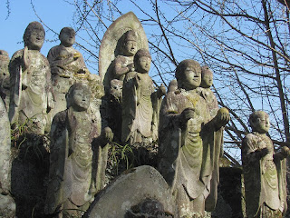
Statues at Ookuboji.

Friday, April 12, 2013

Day 8: Mountain Hiking Holidays Shikoku Pilgrimage Group

A statue of the boddhisattva Jizo (Jizo bosatsu) marks the path to Yokomineji (Temple 60). Jizo is the guardian deity of children and travelers.
The descent from Yokomineji en route to Temple 61 (Kouonji).
The steepest part of the descent from Yokomineji ends here. Notice the walking staffs that others have left leaning against the signpost.
The stark, modern facade of the main building at Kouonji (Temple 61). This concrete and tile structure dates from the 1970s although the temple was founded in the 6th century.This modern building stands in marked contrast with the hondo we have seen at other temples.

Thursday, April 11, 2013

Day 7: Mountain Hiking Holidays Shikoku PIlgrimage Group

Before setting off on our hike from Temple 44 (Daihoji) to Temple 45 (Iwayaji) today, we stopped for a visit at Ishiteji (Temple 51) since some of the group didn't have a chance to visit it yesterday. Here is part of our group at Ishiteji's main hall (hondo).
After our visit to Ishiteji, we drove to the Kuma Kogen ("Bear Plateau") area south and east of Matsuyama. We started our day's hike at this beautiful forest temple called Daihoji (Temple 44). It was lightly raining for most of the day, but the mist and drizzle added a lot of atmosphere to the walk.
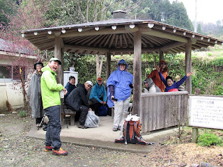
From Daihoji, the route led us over a forested ridge before dropping to a small village in the Kuma Kogen where we stopped for lunch (out of the drizzle) in this thoughtfully placed henro shelter.
A soft, leaf-cushioned path leads through stately woods of Japanese cedars en route from Daihoji to Temple 45 (Iwayaji).
A section of the henro trail between Daihoji and Iwayaji passes through misty woods.
A particularly lovely stretch of trail atop the forested ridge-top between Daihoji and Iwayaji.
This sign reminds walkers to persevere. Ganbatte!
Giant Japanese cedars in the woods just before reaching Temple 45 (Iwayaji). You could almost sense the presence of the old forest kami (gods). Miyazaki's film Spirited Away came to mind...
Suddenly, the temple gate for Iwayaji appears!
The hondo (main hall) at Iwayaji is built against a towering cliff face.
Moss-covered statues at Iwayaji.

Wednesday, April 10, 2013

Day 6: Mountain Hiking Holidays Shikoku Pilgrimage Group

Today, we hiked from Temple 46 (Joruriji) in the south of Matsuyama City to Temple 51 (Ishiteji).
The group hiking through the rural landscapes between Joruriji (Temple 46) and Yasakaji (Temple 47).
At Temple 47 (Yasakaji). 
Henro John at the main gate of Yasakaji.
Our group arrives at Monjuin temple (also known as Tokuseiji), one of the twenty numbered bangai temples. The bangai are sacred temples that are not officially part of the 88 temple pilgrimage route. (Monjuin is bangai #9.) It is said that Monjuin is at or near the site where the merchant Emon Saburo refused to give alms to a monk whom he later realized was Kukai (Kobo Daishi). Following the deaths of his eight sons, Emon Saburo set off on foot circling Shikoku several times in search of Kukai in order to ask forgiveness for refusing to give alms. This is one of the stories that explains the origins of the Shikoku Pilgrimage.
The main gate at Temple 48 (Sairinji).
The main hall (hondo) of Temple 49 (Jodoji) seen through the main gate.
Lovely Hantaji (Temple 50) in later afternoon light.
Pagoda the Temple 51 (Ishiteji), the "Stone Hand Temple."